

You can find on this page the Switzerland satellite map to print and to download in PDF. The Switzerland map from satellite presents new pictures of Switzerland as seen from the sky in Western Europe.

The Switzerland satellite map shows new pictures of Switzerland as seen from the sky. This satellite map of Switzerland will allow you to visit the country Switzerland in Western Europe as seen from the sky. The Switzerland satellite map is downloadable in PDF, printable and free.
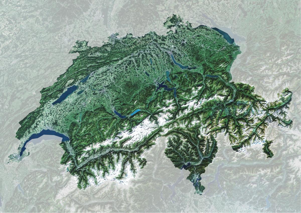
Different geological phenomena shaped the actual landscapes of Switzerland. The alpine orogeny had the most visible consequences nowadays, this term designates the entire geological movements that conducted to the formation of the Alps as you can see in Switzerland satellite map. A crystalline basement formed at the begin of the Paleozoic era, between 540 and 360 millions years ago. Later, between 205 and 96 millions years ago, the alpine ocean or Tethys Ocean formed between Eurasia and Africa. The ocean reached its maximum width at the end of Jurassic period, 135 millions years ago. The collision between the Eurasian and African plates made it progressively disappear. This plate collision, still in progress, began 100 millions years ago. The alpine chain resulted from this geological movement, the two plates creating folding zones. The Central Plateau is mainly composed of molasse, a sedimentary rock which formed at the bottom of the old ocean.
Switzerland occupies an area of 41,285 square kilometers (15,940 sq mi), almost identical in size to the Netherlands. Its Locations as its shown in Switzerland satellite map: Aare River, Berner Alpen, Bieler See, Bodensee, Brienzer See, Doubs River, Glarner Alpen, Lac de la Gruyere, Lac de Neuchatel, Lac Leman, Lake Geneva, Lake of Lucerne, Lepontine Alps, Rhaetian Alps, Rhein River, Rhone River, Sarner See, Sempacher See, The Alps, Thuner See, Ural Mountains, Vierwaldstatter See, Walensee, Zuger See and Zurichsee.
The Swiss Alps occupy the southern part of Switzerland. They were formed by the thrust of the African plate, which also caused the formation of the Jura in the north-east and the plateau between the two massifs. In terms of area the Alps constitute about 60% of the country, the plateau 30% and the Jura 10%. The rugged terrain of the Jura and the Alps are very sparsely populated, except for some large valleys such as the Valais as its mentioned in Switzerland satellite map. Most of the population lives on the plateau where the country major cities such as Geneva, Zurich and Bern are located. It has an extensive system of lakes such as Lake Geneva, Lake Neuchatel, and Lake Constance. Next, the Alps span about 60% of Switzerland, and its snow-capped mountains are visibly picturesque in this satellite map of Switzerland. Approximately 31% of Switzerland is forested like the Po Basin mixed forest region that stretches into Italy.